
|
Training, Open Source Computer Languages |
| Home | Accessibility | Courses | Diary | The Mouth | Forum | Resources | Site Map | About Us | Contact |
| For 2023 (and 2024 ...) - we are now fully retired from IT training. We have made many, many friends over 25 years of teaching about Python, Tcl, Perl, PHP, Lua, Java, C and C++ - and MySQL, Linux and Solaris/SunOS too. Our training notes are now very much out of date, but due to upward compatability most of our examples remain operational and even relevant ad you are welcome to make us if them "as seen" and at your own risk. Lisa and I (Graham) now live in what was our training centre in Melksham - happy to meet with former delegates here - but do check ahead before coming round. We are far from inactive - rather, enjoying the times that we are retired but still healthy enough in mind and body to be active! I am also active in many other area and still look after a lot of web sites - you can find an index ((here)) |
|
Salisbury Plain
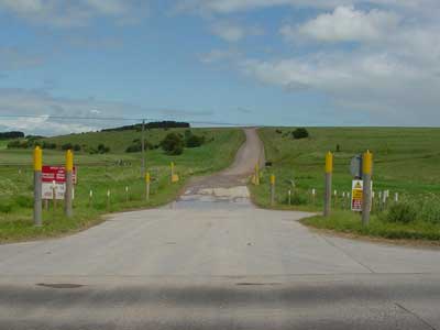 An Army road on Salisbury Plain Salisbury Plain is an area of flat upland that stretches about 15 to 20 miles north from the city of Salisbury itself. It's a remote area for the most part and is heavily used as an army training area. See also Imberranges Map locator - Salisbury_Plain Yet there's a great beauty to The Plain too, and many things to see such as Stonehenge and Woodhenge, the valley of the river Avon at Woodford, and to the North of the Plain, Westburywhitehorse, villages like Westlavington and towns such as Devizes. Near to Sailsbury, you'll find both a regular racecourse and the point to point course at Larkhill on the Plain- if you're lucky enough to be in the area when there's racing on, it's a great outing 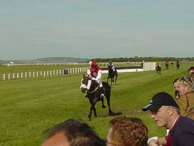 Racing at Larkhill At other times of year, there's a 25 mile walk you can take part in from the stone circle at Avebury to Stonehenge, or occasionally "The Imber Road" will be open and you can see the old village that was temporarily taken over by the Army during the second world war, but hasn't been returned. 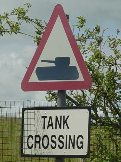 The Army is always about ... |
OPTIONS AVAILABLE TO YOU
You may follow links in the text to explore other topics.Extra link - Return to the HomePage of this share system
STATUS AND CONTROL
You are a guest
This is a page from Well House Consultant's shared information directory. Learn about our shared information system.
Salisbury Plain is about 21 kms from our hotel and training centre - Well House Manor, in Melksham. Business and leisure guests welcome all year.
Other nearby places:
Other nearby places:
Further Information
Follow us on ...
 |  |
PH: 01144 1225 708225 • FAX: 01144 1225 793803 • EMAIL: info@wellho.net • WEB: http://www.wellho.net • SKYPE: wellho
PAGE: http://www.wellho.net/share/salisburyplain.html • PAGE BUILT: Fri Apr 5 18:43:09 2013 • BUILD SYSTEM: wizard